
Clermont ( Charlevoix )
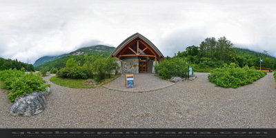
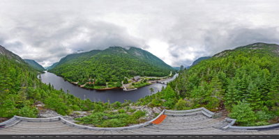
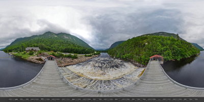
Parc national des Hautes-Gorges-de-la-Rivière-Malbaie was named after a series of valleys cut deep into a range of high mountains.The Hautes-Gorges-de-la-Rivière-Malbaie are among the highest rock faces East of the Rockies! Steep slopes, beautiful natural surroundings, and the unusual course of Rivière Malbaie make this an exceptional site. Come and take a voyage into the heart of the Land of Menaud, where time stops but the spectacle goes on and on. This national park has the privilege of being one of the core zones of the Charlevoix World Biosphere Reserve.
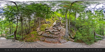
Explore the 14.4 km of trails that wind through our park, ranging from easy to difficult. Raise the curtain on a remarkable territory that wears traces left by time, ice, water and wind. Mountain climbers can meet on the highest peak in the area, Acropole des Draveurs, at 1,048 m in altitude.
This backcountry marvel in the heart of the Charlevoix World Biosphere Reserve can be reached via the picturesque village of Saint-Aimé-des-Lacs.
25, boul. Notre-Dame, Clermont
QC, CA
G4A 1C2

How to get there: Google Maps
Categories: Attractions, Sports and outdoor activities, Wildlife observation, Park and wildlife reserve, Hiking, SEPAQ
Card created: 03/2015 (last modified: 07/2017)
GPS coordinates: 47°42'34.29"N, 70°14'52.78"W
Download for your GPS: (.gpx)