
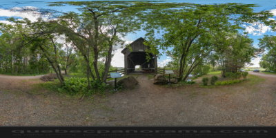
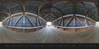
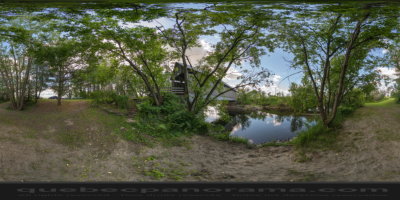
Pont enjambant la rivière Coaticook.
Latitude : 45° 15’ 49.3”
Longitude : -71° 51’ 3.4”
Comment s'y rendre: Google Maps
Catégories: Sites et attraits, Pont couvert
Fiche créée: 06/2014 (dernière modification: 06/2014)
Coordonées GPS: 45°15'49.62"N, 71°51'2.74"O
Télécharger pour votre GPS: (.gpx)