
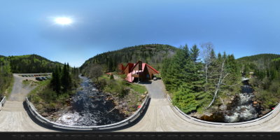
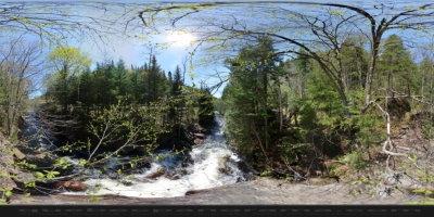
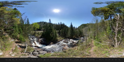
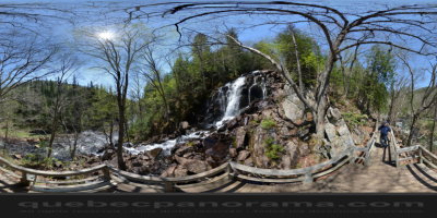
Amid the pristine natural setting of northern Lanaudière, explore the 12 km (7.5 mi.) of hiking trails on mounts Brassard and Barrière, with an altitude of nearly 700 m (2,300 ft.). Feast your eyes on spectacular scenery from the park’s lookout points.
4031, Chemin Brassard Sud, route 131, Saint-Zénon
Québec, Canada, J0K 3N0

How to get there: Google Maps
Categories: Sports and outdoor activities, Wildlife observation, Hiking
Card created: 04/2013 (last modified: 06/2013)
GPS coordinates: 46°26'39.49"N, 73°44'15.88"W
Download for your GPS: (.gpx)