
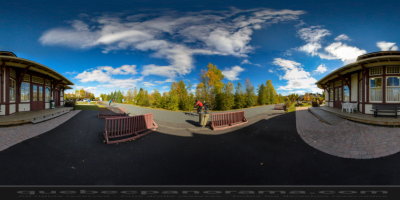
A tourist and recreational trail designed along an old railroad between Bois-des-Filion and Mont-Laurier, this 230 km (143 mi) corridor provides a north-south crossing through the magnificent Laurentian region. Summer activities include cycling, hiking, and inline skating; winter activities include snowmobiling between Labelle and Mont-Laurier (93 km/58 mi), and cross-country skiing between Saint-Jérôme and Val-David (40 km/25 mi, classic and ski skating); mechanical maintenance and easy level. All along the trail, railway stations have been renovated and many have been converted into welcoming cafés and rental and repair shops for sports equipment.
24, rue Saint-Paul Est, Sainte-Agathe-des-Monts
QC, CA
How to get there: Google Maps
Categories: Winter activities, Sports and outdoor activities, Cross-country skiing and snowshoeing, Snowmobiling, Hiking, Cycling
Card created: 04/2013
GPS coordinates: 46°3'6.73"N, 74°17'4.73"W
Download for your GPS: (.gpx)