
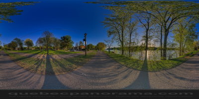
Beautiful trail, which begins at Aimé-Léonard Park and along the Rivière des Prairies. Several picnic areas and benches placed along the way allow to rest or eat.

How to get there: Google Maps
Categories: Sports and outdoor activities, Hiking, Cycling
Card created: 05/2015 (last modified: 05/2015)
GPS coordinates: 45°36'30.33"N, 73°38'24.56"W
Download for your GPS: (.gpx)