
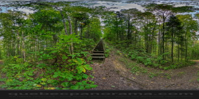
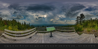
This trail, about one kilometre long, takes you to the viewpoint of the Butte du Bonhomme Blanchet. The viewpoint looks towards the Frontier Route. Access is from the parking of the Snowmobile Club “Les Chevaliers des Frontières” on the road to Saint-Elzéar. A panoramic view with the state of Maine in the background is explained with an orientation table.
529, route Beaupré, Saint-Elzéar, QC G0L 2W0
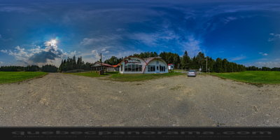
How to get there: Google Maps
Categories: Winter activities, Sports and outdoor activities, Snowmobiling, Hiking
Card created: 09/2015 (last modified: 09/2015)
GPS coordinates: 47°30'9.77"N, 69°5'38.21"W
Download for your GPS: (.gpx)