
Val-Bélair ( Quebec )
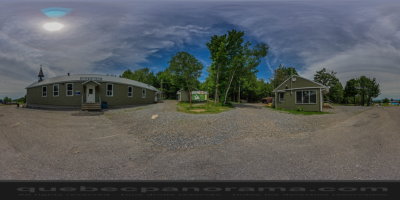
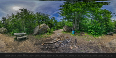
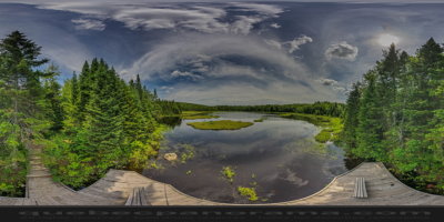
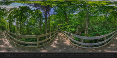
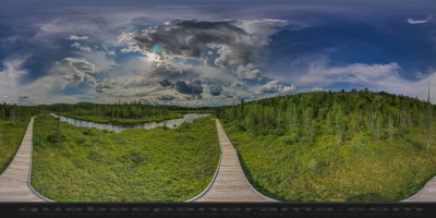
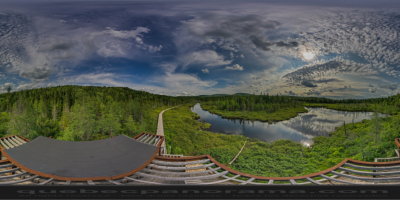
Located in the beautiful natural park of Mont Bélair, the outdoor center La Découverte is a privileged destination. There are also trails for snowshoeing or hiking. By borrowing, you will discover Mount Bélair with its 485 meters, one of the highest in the region. A network of footpaths, with sidewalks on stilts, and an observation tower have been built around Lake Boivin and nearby wetlands. The longest trail is the one who goes down to the bog area. It is well appointed and fairly easy, fairly level. It is a distance of 4 km, so a total of 8 km round trip. An observation tower is equipped at its end to allow the observation of the fauna and flora of the marshes of Lake Boivin. The entire trail is marked.
1560, rue de la Découverte, Val-Bélair QC G3K 2K8


How to get there: Google Maps
Categories: Sports and outdoor activities, Wildlife observation, Hiking
Card created: 07/2015 (last modified: 11/2018)
GPS coordinates: 46°49'50.3"N, 71°27'23.6"W
Download for your GPS: (.gpx)