
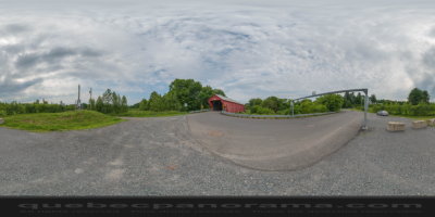
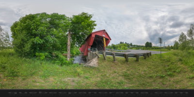
Bridge Freeport Cowansville connects the two banks of the Yamaska River since 1870. He was the first covered bridge in Cowansville. Bridge Farm Town is simple reinforced with dowels hardwood types. Cowansville was once composed of three villages: Sweetsburg, Freeport, and Nelsonville. The bridge was built and put into operation in the village of Freeport, named Freeman Eldridge, a builder in the region which include built the first Anglican church in Freeport in 1855. Combining the three villages will take place in 1876.
How to get there: Google Maps
Categories: Attractions, Covered bridge
Card created: 07/2014 (last modified: 07/2014)
GPS coordinates: 45°13'5.87"N, 72°46'3.33"W
Download for your GPS: (.gpx)