
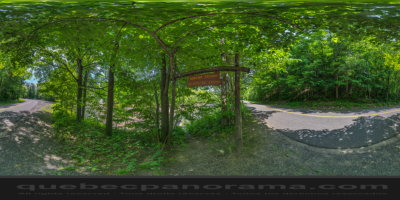
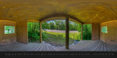
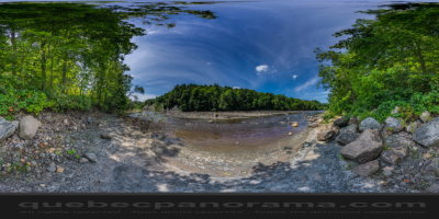
Built on private land by volunteers Ski Club of Fond The Pinière in 2008, the trail 4.5 km offers impressive views of the River Oak. Indeed, many views allow you to admire the cliffs of the canyon of the River Oak containing small white shells deposited at the bottom of the Champlain Sea there are about 10 000 years! The trail winds through a forest of ash, hemlock, maple and old pine trees, among the few remnants of the forests which covered formerly Lotbinière. On the intermediate level of difficulty, the course, however, reserve you some more technical sections. Put on your good walking boots! Access is free. You can make a round trip from the Moulin du Portage or rest area Leclercville.
1080, rang Saint-Francois, à Lotbinière
How to get there: Google Maps
Categories: Sports and outdoor activities, Hiking
Card created: 08/2015 (last modified: 08/2015)
GPS coordinates: 46°33'19.79"N, 71°58'12.62"W
Download for your GPS: (.gpx)