
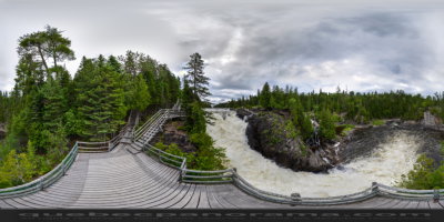
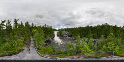
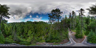
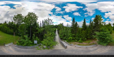
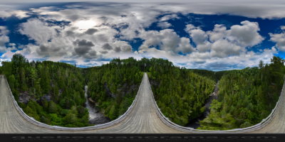
The Canyon des Portes de l’Enfer (hell’s gate canyon) in Saint-Narcisse-de-Rimouski begins with the Grand Sault waterfall and stretches nearly five miles between steep and narrow rock walls up to 90 metres high.A network of easy-to-intermediate hiking trails, from 1 to 14 kilometres, leads to stunning panoramic views and a 63-metre high suspended footbridge, the highest in Quebec.Experience the descent to hell’s gate:300 steps leading down to the Rivière Rimouski — and back up again!At the far end of the trail system is the Chaud waterfall, another 20-metre cascade.A restaurant, a one-star campground and a 7-kilometre bike path are also available for visitors to this magnificent natural site.
1280, chemin Duchénier
Saint-Narcisse-de-Rimouski, Qc, CA
G0K 1S0
How to get there: Google Maps
Categories: Attractions, Sports and outdoor activities, Natural wonders, Wildlife observation, Hiking
Card created: 04/2013 (last modified: 10/2013)
Website: http://www.canyonportesenfer.qc.ca/en/
GPS coordinates: 48°13'50.95"N, 68°30'17.8"W
Download for your GPS: (.gpx)